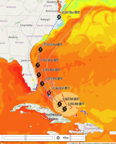
The Ocean Observing and Modeling Group is tracking Hurricane Isaias as it moves from the Caribbean Sea toward the U.S. mainland, in a path that might be very similar to Hurricane Matthew’s (2016).
OOMG’s Hurricane Isaias site allows you to explore the effects the hurricane is having on weather and ocean conditions by changing data layers on the region map. See what conditions Isaias will encounter (warmer ocean temperatures generally increase a hurricane’s intensity) and how Isaias has affected the ocean (look for sea surface temperature cooling on the right side of the hurricane’s path due to upwelling). Other features to explore are sea surface salinity, significant wave height, wave direction, surface winds, rain bands, and GOES satellite visible imagery.
See our interactive map here, and keep informed to keep safe!