OOMG’s project “Using a Coupled Numerical Modeling System to Investigate Flooding Impacts During Hurricane Florence (2018)” was highlighted in the U.S. Geological Survey (USGS)’s Newswave Fall 2021 issue. The goal of this project is to improve storm impact prediction through understanding of a historical hurricane landfall. The project focuses on […]
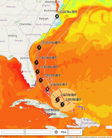
The Ocean Observing and Modeling Group is tracking Hurricane Isaias as it moves from the Caribbean Sea toward the U.S. mainland, in a path that might be very similar to Hurricane Matthew’s (2016). OOMG’s Hurricane Isaias site allows you to explore the effects the hurricane is having on weather and […]
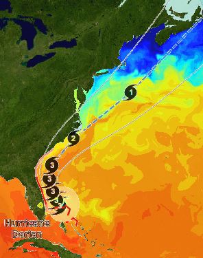
The Ocean Observing and Modeling Group at NC State University is closely watching Hurricane Dorian as it moves northward along the U.S. Atlantic coast. Using our Coupled Northwest Atlantic Prediction System (CNAPS), we are providing a 3-day forecast of the hurricane’s path and intensity, updated daily. CNAPS models ocean conditions, atmospheric […]
Our coupled models, initialized at 8pm on September 7th, have completed and are now able to resolve Irma making landfall in Florida sometime between 2am and 5am Sunday morning. As a result, both the 3 and 7 day runs are capable of resolving the storm and currently point the landfall as […]
Many, many thanks to NC Sea Grant and NC Space Grant for their gracious support and funding for my upcoming project, Investigation of Marine Physical-Biogeochemical Interactions During Storm Conditions Off of the North Carolina Coast. This work will use long-term satellite observations, in-situ data, and numerical model analysis to examine […]
Over the last few days, the 7-day forecast experiment upgrade has been working well. Our output from forecasts initialized on the 6th and 7th are largely in line with the forecast models that the National Hurricane Center (NHC) has been favoring in their forecast tracks. We have been utilizing additional […]
Over the last few weeks, we have been working to expand the current CNAPS forecast from 3 to 7 days. With the appearance of Hurricanes Harvey and Irma, and the peak of the hurricane season on September 10, we were graciously allocated additional computing power from the High Performance Computing (HPC) […]
OOMG member Laura McGee visited Mrs. Schuman’s 5th grade math class at Briarcliff Elementary to give a talk on hurricanes. She used the Coupled Northwest Atlantic Prediction System (CNAPS) forecast of Hurricane Matthew to illustrate the low pressure, high wind, and high wave conditions that occur in hurricanes, and to […]
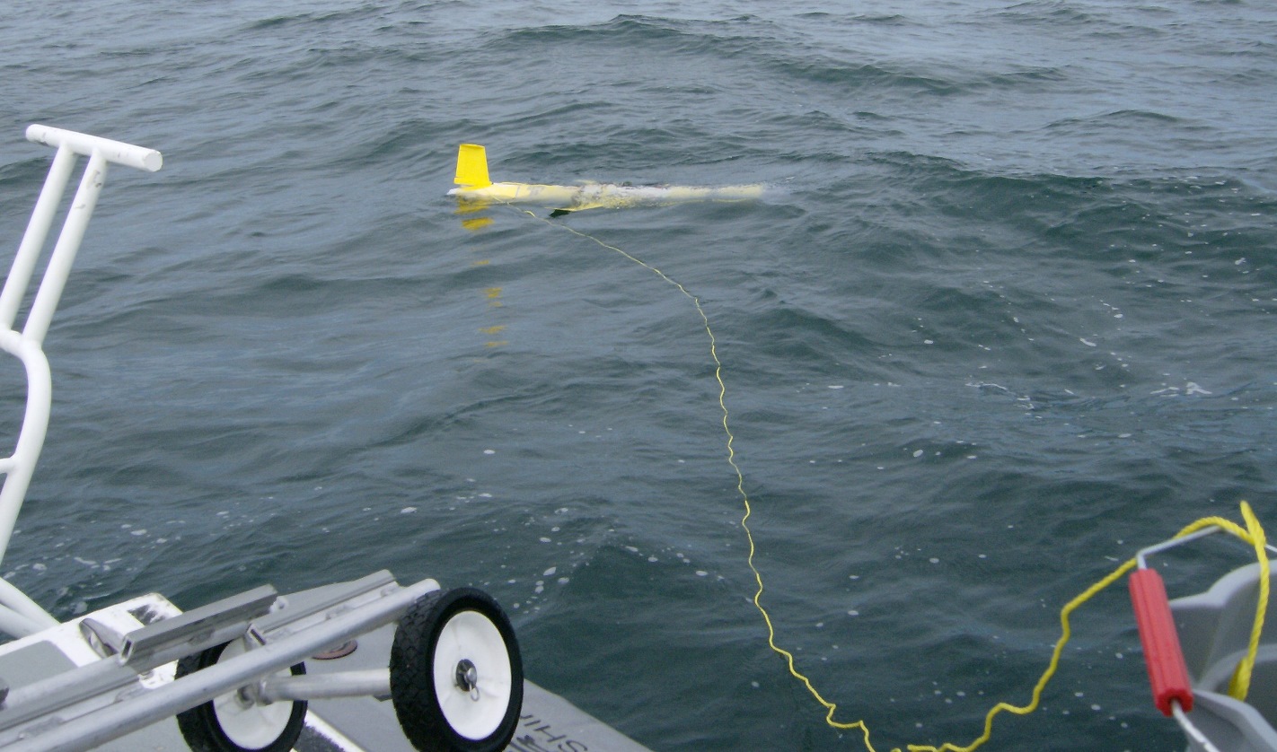
OOMG’s Slocum glider, Salacia, was deployed at Gray’s Reef National Marine Sanctuary off the coast of Georgia on 16 September 2016. Gliders from University of South Florida, Skidaway Institute of Oceanography, and University of North Carolina at Chapel Hill concurrently deployed gliders along the U.S. southeast coast in a practice […]