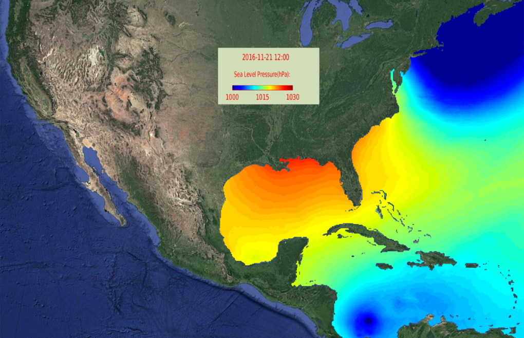
The new Coupled Northwest Atlantic Prediction System (CNAPS) web site allows users to interact with the group’s ocean model of past, present, and three-day future ocean states. Expanding the domain of the SABGOM model, CNAPS covers the ocean from Nova Scotia to Venezuela and west in the north Atlantic, and includes marine weather, ocean waves, ocean circulation, and model validation. In the role of Virtual Oceanographer, users can “collect” real ocean data at all depths for a chosen point or along a user-defined transect, or release virtual particles into the ocean and watch their 72 hour routes. The concept of forecasting the ocean state, much like forecasting the weather, was highlighted in the NC State News and was the subject of Roy’s Coffee and Viz talk on Oct. 14, 2016.